Geocoder#
The Geocoder enables users to convert location text (e.g., country, region, postal address) into geographic coordinates and access it in the map. The search results are stored in a temporary layer, allowing users to download them as a GeoJSON file or add them to the current project if their privileges allow it (i.e., publisher, admin).
How to access a location with the Geocoder?#
Users regardless of their privileges can access the Geocoder from the menu bar located in the top-right corner of the application.
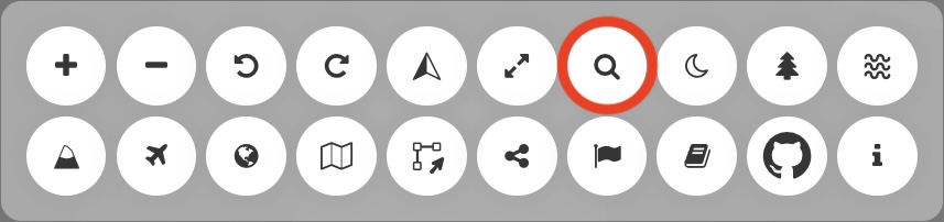
Location of the Geocoder in the menu bar#
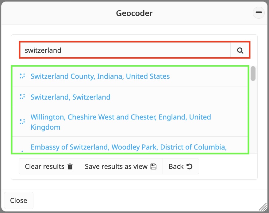
Geocoder panel#
When the Geocoder is activated, users can enter the desired location’s name,
address, or any relevant text in the search bar (red square). After entering
the information, clicking the magnifier button or the Enter key will display
the search results (green square). To navigate to a specific location, simply
click on the corresponding result (purple square). The map will automatically
center on the selected location, and a marker will be added to indicate its
exact geographic position.
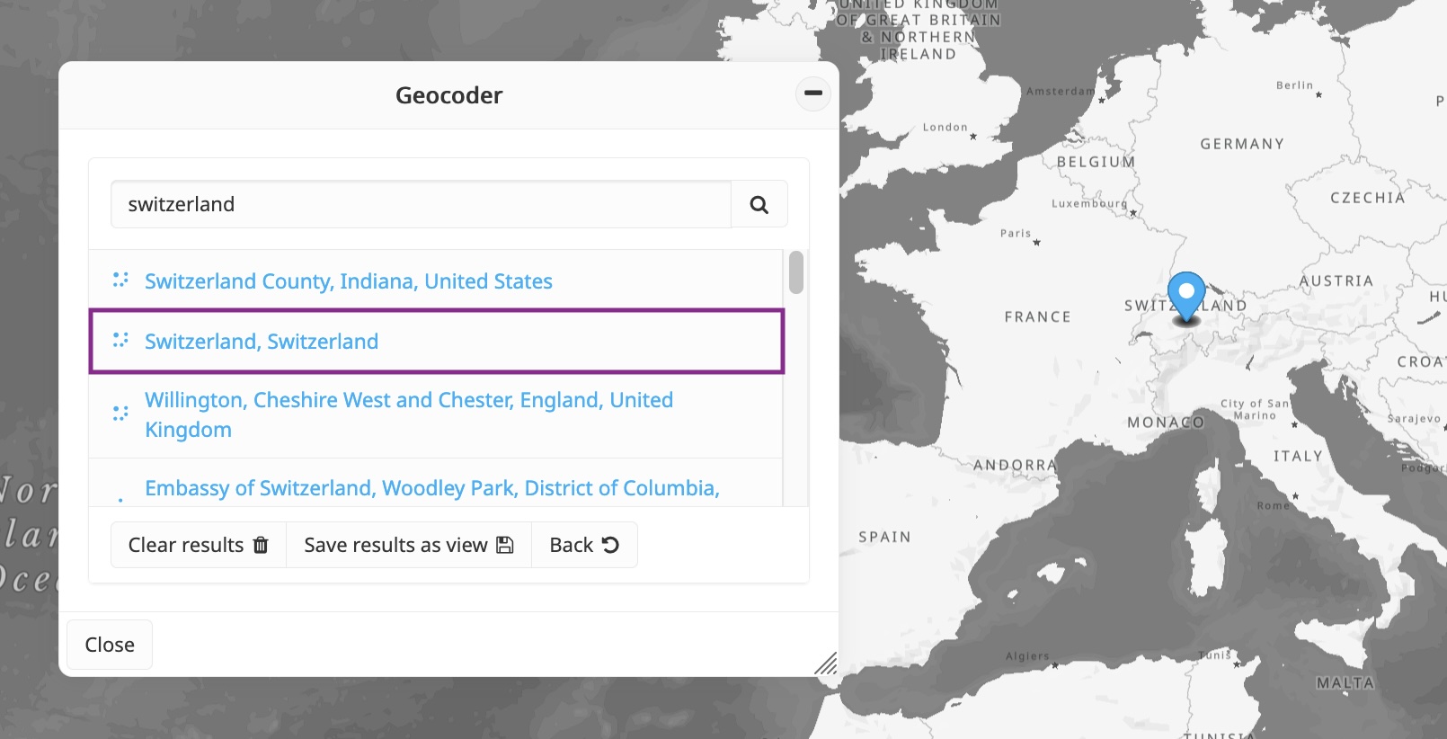
Visualization of a location in the map#
How to preserve these locations?#
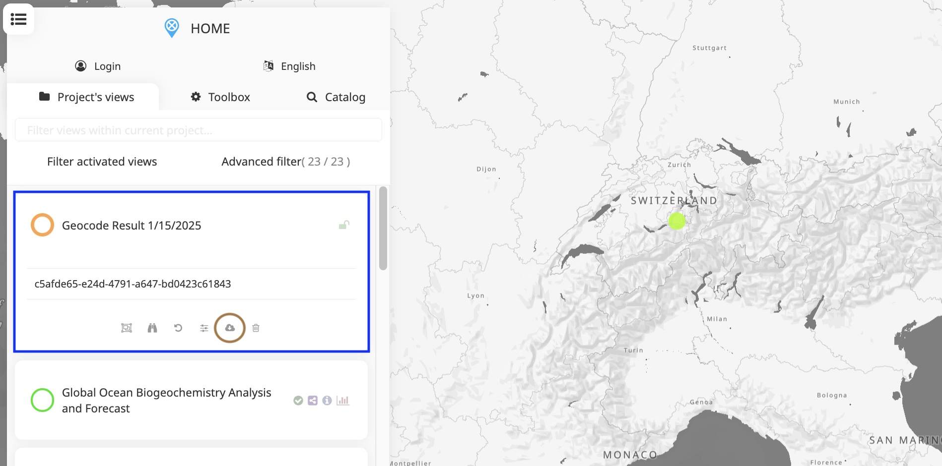
Users can perform multiple searches consecutively, and all clicked results are
kept in the map. This feature allows users to revisit previous locations
by clicking the Back button. Additionally, the Geocoder provides
the option to generate a temporary view containing all visited locations
by clicking the Save results as view button. This view is automatically
added to the top of the data catalog (blue square), making it accessible to
all users for local download in GeoJSON format (brown circle). Publishers
and administrators also have the option to upload the temporary data to
the project for further use.
Temporary view created from the Geocoder#