Draw tool#
The Draw tool enables users to create new datasets by drawing features on the map, to download them once saved and to add them to the current project if their privileges allow it (i.e., publisher, admin).
How to create a new vector layer from scratch in MapX?#
Users regardless of their privileges can access the Draw tool from the menu bar located in the top-right corner of the application.

Location of the Draw tool in the menu bar#
Once the tool is activated, users must first choose the type of geometries that will compose their dataset (no mixing allowed) as well as its name. Once done, the options specific to the draw tool appear in the menu bar. Depending on the type of geometries selected, there are 7 or 8 buttons allowing to perform the following actions (from left to right):

Draw tool options#
Open/close the Draw tool.
Add a feature to the dataset. Each feature is drawn independently of the others using the cursor. For lines and polygons, a double click ends the editing of the element.
Note
The icon of this button varies according to the type of geometry selected.
Add a circle to the dataset by defining its radius in kilometers and its center.
Note
Only available for polygon layers.
Combine selected geometries.
Uncombine selected geometries
Delete selected geometries.
Save the dataset client side in the current project.
Quick access to the tool’s documentation (this page).
Once the creation of the dataset is done, users can click on  to save their view:

Panel to save the dataset in the current project.#
Close the tool allows users to save their dataset in the current project and to close the tool at the same time. Once this option has been chosen, the dataset can no longer be edited in MapX.
Continue editing allows users to save their dataset in the current project and then continue editing it to create another dataset. This option is useful for saving intermediate or alternative versions of a dataset.
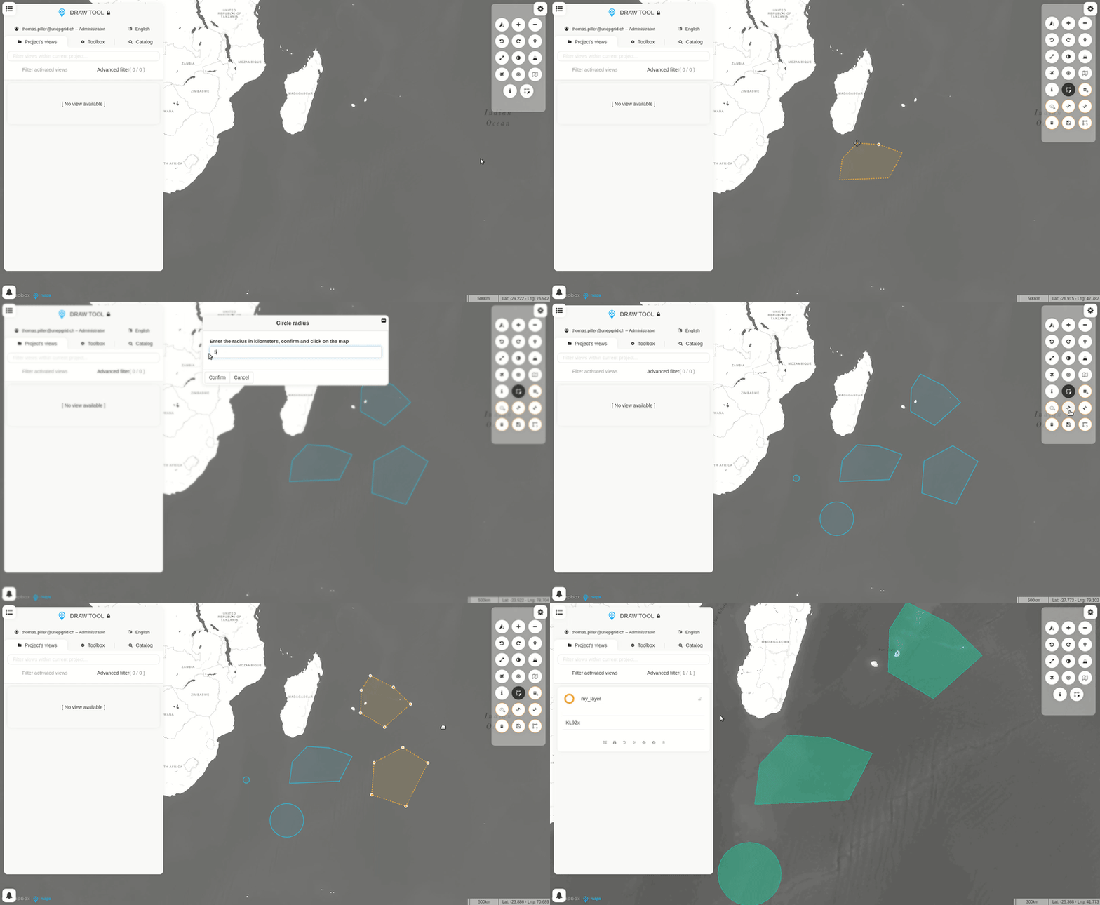
Example of use#

Creating a dataset with the Draw tool.#
