Project configuration#

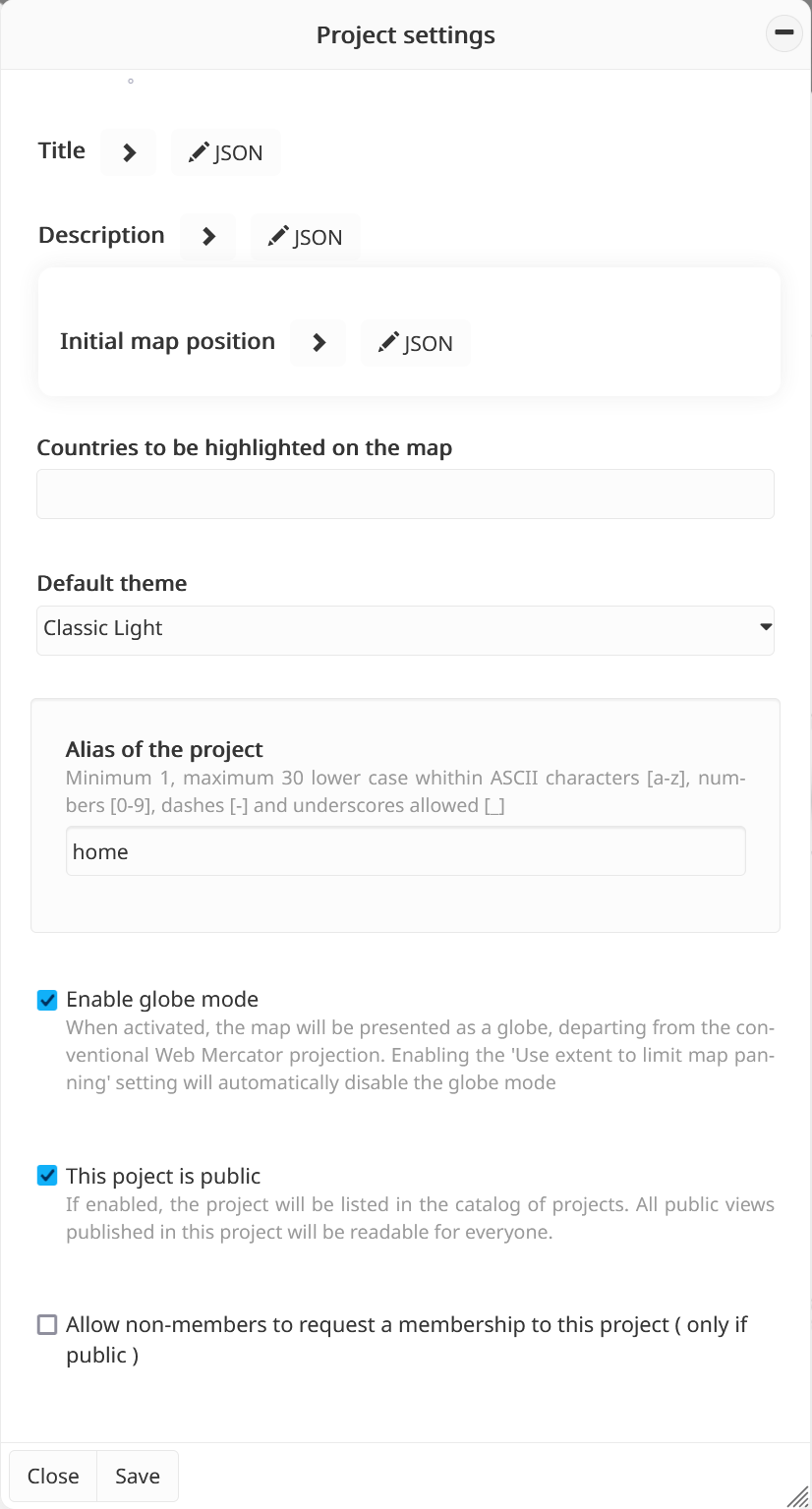
Administrators can access the Project configuration tool from the Toolbox and fill/update the following settings:
Project info#
Title (multilingual)
Description (multilingual): brief summary of the project content.
Alias of the project: a human-readable name used to identify the project, which can also be included in the URL to access it directly.
Organisation details
Name: the name of the organisation managing the project.
Contact name: primary contact person for the project.
Contact email: email address for inquiries related to the project.
Terms of use: project-specific terms that complement the general MapX terms, defining rules and guidelines applicable to this particular project.
Appearance & theme#
Project logo: the logo displayed in the MapX interface for the current project, helping to visually identify the project. The logo must be provided in
SVGformat.Default theme: the theme automatically applied when a user opens the project. This can be a standard MapX theme or a custom theme defined by a project administrator.
Map settings#
Countries to be highlighted on the map: select which countries should be visually emphasized when the project is displayed.
Initial map position: defines the default map position when a user opens the project. Additionally, map panning can be restricted to this defined area, limiting the geographic extent that users can explore. For example, a project focused on the Mediterranean region can be configured to only display that area.
Warning
Enabling the Use extent to limit map panning option (in the Initial map position section) will automatically disable the globe mode.
Map projection: administrators can choose the default display mode for the map, either as a globe or using the Web Mercator projection. It is also possible to disable the globe mode button in the menu bar, preventing users from switching to the globe view.
Access settings#
In addition to the general project settings, MapX provides two options to define the level of accessibility for a project:
Public or private project:
Public projects are visible and searchable in the project list for all MapX users.
Private projects are only accessible to members explicitly added to the project.
Note
It is possible to define specific read permissions for each project view. For example, a private view (accessible only to members) can exist within a public project.
Allow public users to request membership:
Enabling this option allows users who are not currently members to apply for a member role in the project.
This feature complements the Invite a new member tool available to project administrators.
